
Altitude route mapping transforms how trekkers and researchers navigate challenging terrain, combining technology with traditional exploration skills to unlock extraordinary adventures safely and efficiently.
🏔️ Why Altitude Mapping Matters More Than Ever
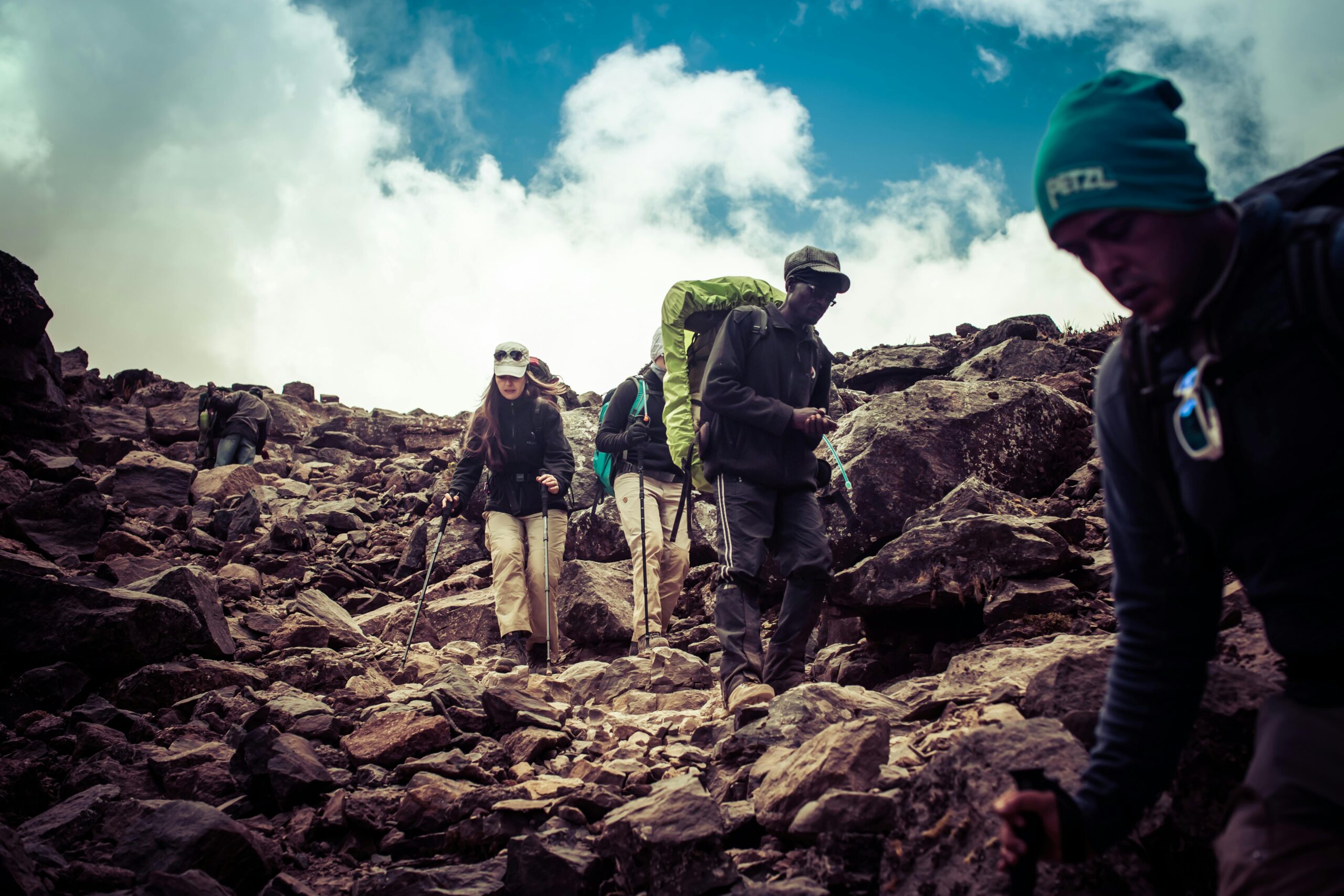
The relationship between humans and high-altitude environments has evolved dramatically over the past decades. What once required extensive expedition teams and months of preparation can now be planned with precision using advanced altitude route mapping techniques. Whether you’re a weekend trekker planning your first multi-day mountain adventure or a researcher studying climate change impacts at elevation, understanding how to map and navigate altitude routes has become an essential skill.
Altitude route mapping goes far beyond simply marking waypoints on a digital map. It encompasses understanding elevation gain, acclimatization zones, weather pattern analysis at different altitudes, emergency evacuation routes, and the physiological impacts of reduced oxygen levels. This comprehensive approach to planning ensures not only successful summit attempts but also safe returns and valuable data collection for research purposes.
Modern trekkers face unique challenges that their predecessors never encountered. Climate change has made traditional routes unpredictable, glacial retreat has altered landscapes, and increased accessibility has brought more people to remote areas than ever before. These factors make accurate, up-to-date altitude mapping not just helpful but essential for responsible mountain travel.
Understanding the Fundamentals of Altitude Navigation
Before diving into advanced mapping techniques, it’s crucial to understand what makes altitude navigation distinct from standard trail navigation. Altitude introduces variables that don’t exist at sea level: oxygen availability decreases approximately 3% for every 1,000 feet gained, weather systems behave differently, and physical performance changes dramatically as you ascend.
Successful altitude route mapping begins with understanding topographic principles. Contour lines on maps represent elevation changes, and learning to read these correctly helps predict terrain difficulty, identify potential hazards, and estimate realistic travel times. The spacing between contour lines tells a story: closely packed lines indicate steep terrain requiring technical skills, while widely spaced lines suggest gentler slopes suitable for steady progress.
Essential Components of Altitude Route Planning
Every comprehensive altitude route map should incorporate several critical elements. First, elevation profiles that show not just total altitude gain but also the pattern of ascent and descent throughout your route. This information helps plan acclimatization strategies and identify optimal camping locations at appropriate elevations.
Second, waypoints must include more than just GPS coordinates. Effective waypoints note elevation, estimated time from previous points, water availability, shelter options, and any known hazards. This detailed approach creates a living document that serves both as a planning tool and a field reference.
Third, escape routes must be identified and mapped at regular intervals. Mountain weather can change in minutes, and having predetermined safe descent options marked on your map could mean the difference between an inconvenience and a life-threatening situation.
Technology Tools That Transform Altitude Mapping
The digital revolution has brought unprecedented capabilities to altitude route mapping. GPS devices now provide real-time positioning accurate to within meters, satellite imagery reveals terrain details invisible from ground level, and smartphone applications put professional-grade mapping tools in every trekker’s pocket.
Modern mapping applications offer features specifically designed for altitude navigation. Three-dimensional terrain visualization helps you understand what lies ahead, offline map storage ensures navigation capability without cell service, and track recording documents your exact route for future reference or sharing with others.
Weather forecasting applications have become invaluable for altitude planning. High-elevation weather differs significantly from valley conditions, and specialized forecasts that provide altitude-specific predictions for wind speed, temperature, and precipitation help trekkers make informed decisions about timing and route selection.
Integrating Traditional and Digital Navigation Methods
Despite technological advances, smart explorers never rely exclusively on digital tools. Batteries die, devices fail, and electronics can malfunction in extreme cold or wet conditions. The most capable altitude navigators master both traditional compass-and-map skills and modern GPS technology, using each to complement the other.
Paper maps remain relevant for several important reasons. They provide a broader spatial context than small device screens, they don’t require batteries, and the act of planning routes on paper often reveals insights that digital planning might miss. Many experienced mountaineers still prefer paper maps for initial route planning, then transfer their routes to digital devices for field use.
Physiological Considerations in Route Planning
Understanding how altitude affects human physiology is crucial for creating realistic route maps. The human body requires time to adapt to reduced oxygen availability, and rushing acclimatization leads to acute mountain sickness, pulmonary edema, or cerebral edema—all serious conditions that can prove fatal if ignored.
Effective altitude route mapping incorporates acclimatization principles directly into the route design. The general guideline suggests ascending no more than 300-500 meters per day above 3,000 meters elevation, with rest days scheduled every 3-4 days of climbing. Your route map should reflect these principles, showing realistic daily stages that allow proper adaptation.
Calculating Realistic Time Estimates at Altitude
Standard hiking time calculations break down at altitude. The commonly used Naismith’s Rule—allowing one hour for every 5 kilometers traveled plus 30 minutes for every 300 meters of ascent—must be modified for high-altitude conditions. Above 3,000 meters, most trekkers should add 25-50% to calculated times, and above 5,000 meters, doubling standard time estimates often proves more accurate.
Individual variation becomes significant at altitude. Fitness level, previous altitude experience, genetic factors, and even subtle health conditions affect performance. Your route mapping should include buffer time and flexibility to accommodate these variables without compromising safety or success.
Research Applications of Altitude Route Mapping
For researchers, altitude route mapping serves purposes beyond navigation. Scientific studies in mountain environments require systematic spatial sampling, repeat visits to specific locations, and precise georeferencing of data collection points. Proper route mapping ensures research protocols can be followed accurately and that studies can be replicated by future researchers.
Climate researchers studying glacial retreat, botanists documenting vegetation zone shifts, wildlife biologists tracking high-altitude species, and geologists examining mountain formation processes all depend on accurate altitude route mapping. These applications demand higher precision than recreational trekking, often requiring differential GPS units and detailed survey-grade mapping.
Documenting and Sharing Route Information
The research community benefits enormously when altitude route information is properly documented and shared. Digital platforms now allow researchers to upload detailed route information including access logistics, permit requirements, seasonal considerations, and scientific site descriptions. This collaborative approach reduces redundant effort and accelerates scientific understanding of mountain environments.
Standardized data formats have emerged for sharing altitude route information. GPX files contain track data that any GPS device or mapping application can read, while KML files add rich descriptive information viewable in programs like Google Earth. Understanding these formats allows researchers to contribute to and benefit from the collective knowledge base.
Safety Protocols Built Into Route Design
The best altitude route maps incorporate safety considerations from the initial planning stage. This means identifying objective hazards like avalanche zones, rockfall areas, glacier crevasse fields, and exposure to lightning. These hazards should be marked clearly on your map with notes about seasonal variations and strategies for safe passage.
Communication plans must be integrated into route mapping. Modern satellite communication devices allow two-way messaging from anywhere on Earth, but they require clear protocols. Your route map should include scheduled check-in points where you’ll send location updates, and predetermined messages that trigger emergency responses if not received.
Emergency Response Planning
Every altitude route map should answer this question: if something goes wrong at any point along this route, what’s the fastest way to reach medical care? This requires identifying not just descent routes but also potential helicopter landing zones, locations with cell service, and distances to trailheads or settlements.
Helicopter evacuation zones deserve special attention in altitude route mapping. Not all terrain suitable for ground travel can accommodate helicopter operations. Marking potential landing zones along your route—flat areas at least 25 meters in diameter without overhead obstacles—provides critical information for emergency responders.
Seasonal and Weather Considerations
Altitude route mapping cannot be separated from temporal considerations. A route perfectly safe in August might be deadly in January. Snow conditions, river crossings, avalanche danger, storm frequency, and daylight hours all vary seasonally and must inform route planning.
Weather patterns at altitude often defy intuition developed at lower elevations. Afternoon thunderstorms build with regularity in many mountain ranges, creating lightning hazards for anyone exposed on ridges or summits. Mapping routes that minimize exposed travel during typical storm windows demonstrates sophisticated planning that keeps explorers safe.
Creating Adaptive Route Plans
Rigid route plans often fail in mountain environments. The most effective altitude route maps include primary routes with clearly marked alternatives that can be activated based on conditions encountered. This might mean lower-elevation variants for poor weather, or more challenging high routes when conditions prove exceptional.
Decision points should be marked explicitly on route maps—locations where choices must be made about continuing, descending, or taking alternative routes. These decision points should include objective criteria for making the choice, removing emotion from potentially life-or-death decisions made in challenging conditions.
Building Your Altitude Mapping Skill Set
Mastery of altitude route mapping develops through progressive experience. Start with day hikes that involve significant elevation gain, using these experiences to calibrate your personal response to altitude and test your planning accuracy. Document what worked, what didn’t, and how actual conditions compared to your predictions.
Formal training accelerates skill development. Navigation courses taught by mountaineering organizations cover map reading, GPS use, route finding, and decision-making frameworks. These courses provide structured learning that complements field experience and often reveal blind spots in self-taught navigation skills.
Practice Exercises That Build Competence
Several exercises help develop altitude route mapping abilities without requiring immediate mountain travel. Study topographic maps of areas you know well, predicting what terrain features you’ll encounter based on contour patterns. Then visit those areas and verify your predictions, noting where your interpretation was accurate and where it missed nuances.
Virtual route planning using online tools builds familiarity with route mapping workflows. Choose a famous mountain route and plan it in detail using satellite imagery, topographic maps, and trip reports. Then compare your plan to established routes used by professional guide services, identifying differences and understanding the reasoning behind established route choices.
🌍 Environmental Responsibility in Route Selection
Modern altitude route mapping must incorporate environmental considerations. High-altitude ecosystems are fragile and slow to recover from damage. Route selection should minimize impact by using established trails where they exist, avoiding sensitive vegetation zones, and distributing camping impact across multiple sites rather than concentrating it in a few locations.
Leave No Trace principles apply with extra force at altitude. Your route map should identify where human waste disposal presents challenges, note distances to water sources that require protection, and flag areas where camping should be avoided entirely to prevent ecosystem damage. This environmental awareness separates thoughtful explorers from those who love mountains to death.
The Future of Altitude Route Mapping
Emerging technologies promise to transform altitude route mapping further. Augmented reality systems will overlay navigation information directly onto your view of the landscape. Machine learning algorithms will analyze vast datasets of successful and unsuccessful routes to suggest optimal paths. Satellite systems will provide near-real-time information about trail conditions, snow depth, and other variables currently requiring speculation.
Despite these advances, the fundamentals remain constant. Understanding terrain, respecting altitude’s physiological effects, planning for weather variations, and maintaining appropriate humility before mountain environments will always form the foundation of successful altitude exploration. Technology amplifies these fundamentals rather than replacing them.
Empowering Your Next Mountain Adventure
Mastering altitude route mapping transforms you from a mountain visitor into a mountain navigator—someone who understands not just where they are but where they’re going, what challenges lie ahead, and how to respond when conditions change. This competence builds confidence that allows you to tackle more ambitious objectives safely and increases enjoyment by reducing uncertainty and anxiety.
The investment in developing these skills pays dividends across every mountain adventure you undertake. Whether you’re trekking to Everest Base Camp, researching alpine plant communities, or exploring lesser-known ranges in search of solitude, altitude route mapping skills make you more capable, safer, and more effective. Your inner explorer awakens not just through desire for adventure but through the competence to pursue it wisely.
Start your altitude mapping journey today. Pull out maps of nearby mountains, download mapping applications, and begin planning your next trek with the comprehensive approach outlined here. Each route you map builds skills and knowledge that compound over time, gradually transforming you into the confident, capable mountain explorer you aspire to become. The peaks are calling—answer them with the preparation and respect they deserve. 🏔️


