
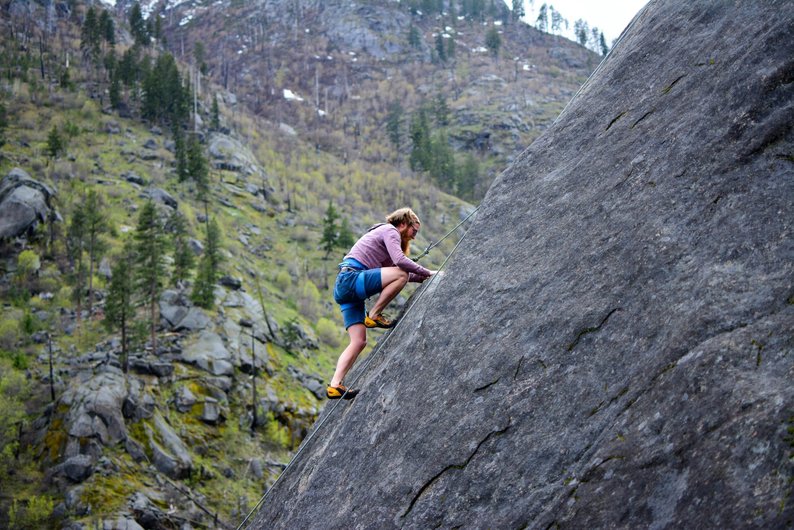
Understanding how elevation affects running pace is crucial for trail runners, mountaineers, and endurance athletes who venture into vertical terrain.
🏔️ The Hidden Tax of Going Uphill
Every runner knows that climbing feels harder than running on flat ground. But how much harder? And more importantly, how can we quantify this difference to better plan our training and racing strategies? The energy cost of altitude gain represents one of the most significant yet often underestimated factors in pace modeling for mountain and trail activities.
Traditional pace calculators work reasonably well for flat terrain, but they fall dramatically short when vertical gain enters the equation. A runner who maintains eight-minute miles on flat ground might slow to fifteen or even twenty-minute miles on steep climbs, and this isn’t due to lack of fitness—it’s simple physics and physiology working together.
The relationship between elevation gain and energy expenditure has fascinated exercise scientists for decades. Unlike flat running where you’re primarily moving horizontally, climbing requires you to lift your entire body mass against gravity, adding a substantial vertical component to your energy output.
⚡ The Science Behind Vertical Energy Expenditure
When you run or hike uphill, your body performs additional work that doesn’t exist on flat terrain. This work is directly proportional to your body weight, the vertical distance climbed, and gravity’s constant pull. The basic physics equation—work equals force times distance—applies perfectly here.
Research has consistently shown that climbing one meter vertically requires approximately 10 times more energy than covering one meter horizontally. This 10:1 ratio serves as a foundational principle in most altitude-adjusted pace models and has been validated across numerous studies involving runners, hikers, and mountaineers of varying abilities.
However, the energy cost isn’t purely mechanical. Your cardiovascular system must deliver significantly more oxygen to working muscles during climbs. Heart rate typically increases by 20-40 beats per minute on moderate grades compared to flat running at the same perceived effort level.
Metabolic Adaptations During Climbing
Your body shifts its fuel utilization patterns when climbing. Steep ascents rely more heavily on carbohydrate metabolism compared to fat oxidation, which means you deplete glycogen stores faster. This metabolic shift explains why even well-trained athletes experience rapid fatigue on long climbs without proper fueling strategies.
The recruitment of muscle fibers also changes dramatically. Climbing activates your glutes, calves, and hip flexors more intensely than flat running, while reducing the contribution from your hamstrings. This altered biomechanical pattern means that even if your cardiovascular system could maintain pace, your muscular system might fail first.
📊 Quantifying the Elevation Cost in Pace Models
Several mathematical models attempt to predict pace adjustments for altitude gain. The most widely used approach converts vertical meters into equivalent horizontal distance using various conversion factors. The challenge lies in determining which factor best represents real-world performance across different grades and fitness levels.
The simplest model uses a fixed conversion: every 10 meters of elevation gain equals approximately 100 meters of horizontal distance. This 1:10 ratio provides a reasonable starting point, though it oversimplifies the complex relationship between grade and effort.
More sophisticated models recognize that the energy cost per vertical meter isn’t constant—it varies with grade steepness. On gentle slopes under 5%, the penalty is relatively modest. Between 5-15% grade, the relationship remains fairly linear. Beyond 15%, efficiency decreases further as biomechanics become increasingly compromised.
The Elevation Adjustment Formula
A practical formula used by many trail runners and race directors calculates adjusted distance as: Adjusted Distance = Horizontal Distance + (Elevation Gain × Conversion Factor). The conversion factor typically ranges from 8 to 12, depending on terrain difficulty and grade steepness.
For example, a 10-kilometer run with 500 meters of elevation gain might calculate as: 10 km + (0.5 km × 10) = 15 km equivalent flat distance. If your flat 10K pace is 6 minutes per kilometer, you might expect this mountainous 10K to take roughly 90 minutes instead of 60.
🎯 Factors That Influence Individual Altitude Cost
Not all runners experience the same energy cost when climbing. Several personal factors significantly influence how much elevation gain affects your pace, making individualized modeling essential for accurate predictions.
Body weight plays the most obvious role. Heavier runners must do more work against gravity to lift their mass upward, resulting in greater energy expenditure per vertical meter. A 90-kilogram runner expends approximately 50% more energy climbing than a 60-kilogram runner covering the same elevation.
Running economy—how efficiently you use oxygen at a given pace—varies considerably among athletes. Runners with superior economy maintain better pace on climbs because they extract more mechanical work from each liter of oxygen consumed.
Training Specificity Matters
Athletes who regularly train on hills develop specific adaptations that reduce the energy cost of climbing. These adaptations include enhanced muscle fiber recruitment patterns, improved biomechanics, and greater tolerance for the lactate accumulation that occurs during steep ascents.
Conversely, runners who train exclusively on flat terrain often experience disproportionate pace degradation on hills. Their muscles lack the specific strength-endurance required for sustained climbing, and their pacing intuition fails them in vertical terrain.
🗺️ Terrain Variables Beyond Simple Elevation
Real-world pace modeling must account for more than just total elevation gain. The distribution of climbing throughout a route dramatically affects overall pace and energy expenditure.
A route with 1000 meters gained gradually over 20 kilometers feels entirely different from the same gain concentrated in two steep climbs. The former allows for steadier effort distribution, while the latter forces periods of very high intensity followed by recovery.
Technical terrain adds another layer of complexity. Rocky, root-filled trails require constant attention and micro-adjustments that increase energy cost beyond what elevation alone would predict. Smooth dirt roads at the same grade allow for more efficient movement patterns.
Downhill: Not a Free Ride
While descent requires less cardiovascular effort than climbing, it’s not energetically free. Eccentric muscle contractions during downhill running cause significant muscular damage and fatigue, particularly in the quadriceps. Steep descents also demand concentration and technical skill that add psychological fatigue.
Most pace models assign a smaller penalty to downhill sections—perhaps treating 10 meters of descent as equivalent to 20-30 meters of horizontal distance rather than providing a time bonus. This acknowledges that while you can run faster downhill, the muscular and technical costs prevent full energy recovery.
💡 Practical Applications for Training and Racing
Understanding elevation energy cost transforms how you approach mountain training and racing. Rather than blindly following flat-ground training paces, you can adjust expectations based on terrain to maintain appropriate effort levels.
For training runs, using heart rate or perceived effort provides better guidance than pace on hilly routes. A tempo run in the mountains might show paces three minutes per mile slower than your flat tempo pace, yet deliver the same physiological stimulus when elevation is factored in.
Race pacing becomes particularly critical in mountain events. Starting too fast on early climbs depletes glycogen stores and accumulates fatigue that compounds throughout the race. Successful mountain racers pace by effort, not by the watch, trusting their models to predict appropriate overall times.
Tools That Incorporate Elevation Modeling
Modern GPS watches and training platforms increasingly incorporate elevation-adjusted pace metrics. These tools calculate your “grade adjusted pace” in real-time, showing what your current effort would translate to on flat ground. This allows for more consistent effort distribution across varied terrain.
Strava, for instance, uses grade adjusted pace (GAP) to normalize performances across different terrains, making it possible to compare efforts on hilly routes to flat benchmark runs. While not perfect, these algorithms provide useful approximations for most recreational athletes.
🧮 Advanced Modeling Approaches
Researchers and elite athletes employ increasingly sophisticated models that account for grade-specific efficiency curves, altitude effects on oxygen availability, and individual physiological profiles. These models move beyond simple linear relationships to capture the true complexity of mountain performance.
Some advanced models incorporate power-based metrics, borrowed from cycling science. Running power meters measure the actual work performed, including the vertical component, providing direct measurement rather than estimation. While still evolving, power-based pace modeling shows promise for precision that pace alone cannot achieve.
Machine learning algorithms trained on thousands of performances can predict individual pace adjustments with impressive accuracy. These systems learn your specific response to various grades and terrain types, creating personalized models that improve with each activity you record.
Limitations of Current Models
Despite advances, all current models have limitations. They struggle with extreme grades above 25-30% where hiking becomes more efficient than running. They can’t fully account for accumulated fatigue in ultra-distance events where muscle damage and glycogen depletion create compounding effects.
Environmental factors like heat, humidity, and altitude add variables that interact with grade in complex ways. A climb that feels manageable in cool conditions might become devastatingly difficult in heat, yet most models don’t adjust for these interactions.
🚀 Optimizing Your Personal Altitude Cost Profile
Rather than relying solely on generic models, serious mountain athletes benefit from determining their individual elevation cost factors through testing and data analysis. This personalized approach yields more accurate predictions and better-informed training decisions.
Conducting field tests on measured climbs provides direct data. Run a known flat route at steady effort, then tackle a measured climb at the same effort level. Compare paces and calculate your personal conversion factor. Repeat across different grades to build a complete profile.
Analyzing historical data from GPS activities reveals patterns in your altitude cost. Export activities with significant elevation to spreadsheets, calculate adjusted paces using different conversion factors, and determine which formula best matches your actual performance patterns.
Progressive Adaptation Strategies
Improving your altitude cost efficiency requires specific training stress. Hill repeats, long vertical gain days, and strength training all contribute to adaptations that reduce the energetic penalty of climbing.
Plyometric exercises and explosive strength work enhance your ability to generate force rapidly, crucial for maintaining pace on steep grades. Core stability training improves your ability to transfer power efficiently through compromised positions required by technical climbing.
Gradual exposure to increasing vertical loads allows physiological adaptations without excessive injury risk. Starting with routes containing 50-75 meters per kilometer of elevation gain and progressing to 100+ meters per kilometer over months builds specific endurance.
🌄 The Mental Game of Mountain Pacing
Beyond physiology, succeeding in vertical terrain requires psychological adaptation. Watching your pace slow dramatically on climbs can be demoralizing unless you’ve mentally prepared and trust your elevation-adjusted models.
Experienced mountain runners develop mantras and mental frameworks that acknowledge the slower pace as appropriate and strategic. They celebrate maintaining consistent effort rather than fixating on diminished speed. This mindset shift prevents the discouragement that leads many runners to push too hard on climbs.
Breaking long climbs into segments creates achievable micro-goals that maintain motivation. Rather than focusing on a daunting 800-meter ascent, you tackle four 200-meter segments, each with its own mini-victory upon completion.
🎓 Translating Understanding Into Performance
Knowledge of altitude energy cost means little without translation into actionable strategies. The most successful mountain athletes develop intuitive pacing sense built on understanding these principles combined with accumulated experience.
They start races conservatively, banking energy for later climbs when accumulated fatigue magnifies the energy cost. They fuel aggressively before and during climbs, knowing carbohydrate availability becomes limiting. They practice the specific muscular patterns required for efficient climbing until they become automatic.
Perhaps most importantly, they recognize that mountains demand humility. The athlete who respects elevation’s energy cost and plans accordingly will outperform the stronger athlete who ignores it and pays the price in the second half of their race.
⛰️ Embracing the Vertical Challenge
The energy cost of altitude gain transforms running from a primarily horizontal endeavor into a three-dimensional challenge. This vertical dimension adds complexity to pace modeling but also depth to the sport. Understanding and accounting for elevation makes you a more complete athlete and opens terrain that remains intimidating to those who ignore these principles.
As modeling tools continue improving and individualized data becomes more accessible, athletes can train and race with unprecedented precision. Yet the fundamental truth remains unchanged: going uphill costs energy, and successful mountain performance requires acknowledging, respecting, and strategically managing that cost.
Whether you’re planning your first trail race, attempting a new mountain route, or simply trying to understand why hills feel so hard, recognizing the quantifiable energy cost of altitude gain provides both explanation and empowerment. You can now predict, prepare for, and ultimately conquer the vertical challenges that once seemed insurmountable.


