
Understanding elevation zones and their environmental risks is crucial for adventurers, athletes, and outdoor enthusiasts who venture into mountainous terrain worldwide.
🏔️ The Vertical Challenge: Why Elevation Matters
Every meter you ascend above sea level transforms the environment around you. Temperature drops, oxygen becomes scarce, and ultraviolet radiation intensifies. These changes aren’t merely inconvenient—they can become life-threatening if you’re unprepared. The human body evolved at sea level, and when we push beyond our biological comfort zone, understanding the risks becomes essential for survival.
Mountaineers, hikers, cyclists, and trail runners face unique challenges as they gain elevation. From the thermal stress of high-altitude deserts to the bone-chilling cold of alpine peaks, each elevation zone presents distinct physiological threats. Recognizing these high-risk zones allows adventurers to prepare adequately, adjust their expectations, and potentially save their lives.
Heat Stress at Moderate Elevations: The Paradox Zone
Contrary to popular belief, heat stress doesn’t only occur at sea level. The zone between 1,500 and 3,000 meters presents a unique thermal challenge. At these elevations, the air is thinner, allowing more intense solar radiation to reach the ground, yet temperatures remain warm enough during midday to create dangerous heat conditions.
The Colorado Plateau, Ethiopian Highlands, and parts of the Andes exemplify this paradox. Hikers often underestimate heat risk at moderate altitude because they associate mountains with cold. However, the combination of intense UV exposure, reduced air density affecting heat dissipation, and deceptively warm daytime temperatures creates a perfect storm for heat exhaustion.
Recognizing Heat-Risk Elevation Characteristics
Several factors converge to make moderate elevations particularly hazardous for heat-related illness:
- Reduced atmospheric filtering allows 10-15% more UV radiation per 1,000 meters gained
- Lower humidity accelerates dehydration without obvious sweating
- Increased respiratory rate at altitude causes additional moisture loss
- Darker soil and rock surfaces absorb and radiate heat more intensely
- Limited vegetation provides minimal shade protection
Athletes training at moderate altitude face compounded risks. The body’s increased metabolic demands combine with environmental heat stress, creating situations where core temperature can rise dangerously fast. Marathon training camps in places like Flagstaff, Arizona (2,100m) or Addis Ababa, Ethiopia (2,355m) must carefully schedule activities to avoid peak heat hours.
❄️ Cold Exposure: Where Temperature Plummets
The temperature drops approximately 6.5°C for every 1,000 meters of elevation gain in normal atmospheric conditions. This lapse rate means that a pleasant 20°C day at sea level translates to a frigid -6°C at 4,000 meters—without accounting for wind chill, which can make conditions feel exponentially colder.
The critical cold-risk zone begins around 2,500 meters in temperate climates and can start as low as 1,500 meters in polar regions. Above 3,500 meters, cold becomes the dominant threat year-round, with nighttime temperatures regularly dropping below freezing even during summer months.
High-Risk Cold Zones Around the Globe
Different mountain ranges present varying cold-exposure profiles based on latitude, maritime influence, and continental positioning:
| Region | Critical Cold Zone Begins | Extreme Risk Above |
|---|---|---|
| European Alps | 2,800m | 4,000m |
| Rocky Mountains | 3,200m | 4,200m |
| Himalayas | 4,500m | 6,000m |
| Andes (Tropical) | 4,200m | 5,500m |
| Scandinavian Mountains | 1,200m | 1,800m |
Cold injuries including frostbite, hypothermia, and non-freezing cold injuries become increasingly likely as elevation increases. The combination of reduced oxygen availability and cold stress forces the body to work harder to maintain core temperature while simultaneously struggling with decreased aerobic capacity.
The Wind Factor: Multiplying Cold Danger
Wind speed increases with elevation due to reduced surface friction. Exposed ridges and summits often experience winds 2-3 times stronger than sheltered valleys below. This creates wind chill that can transform a manageable -10°C into a life-threatening -30°C equivalent temperature.
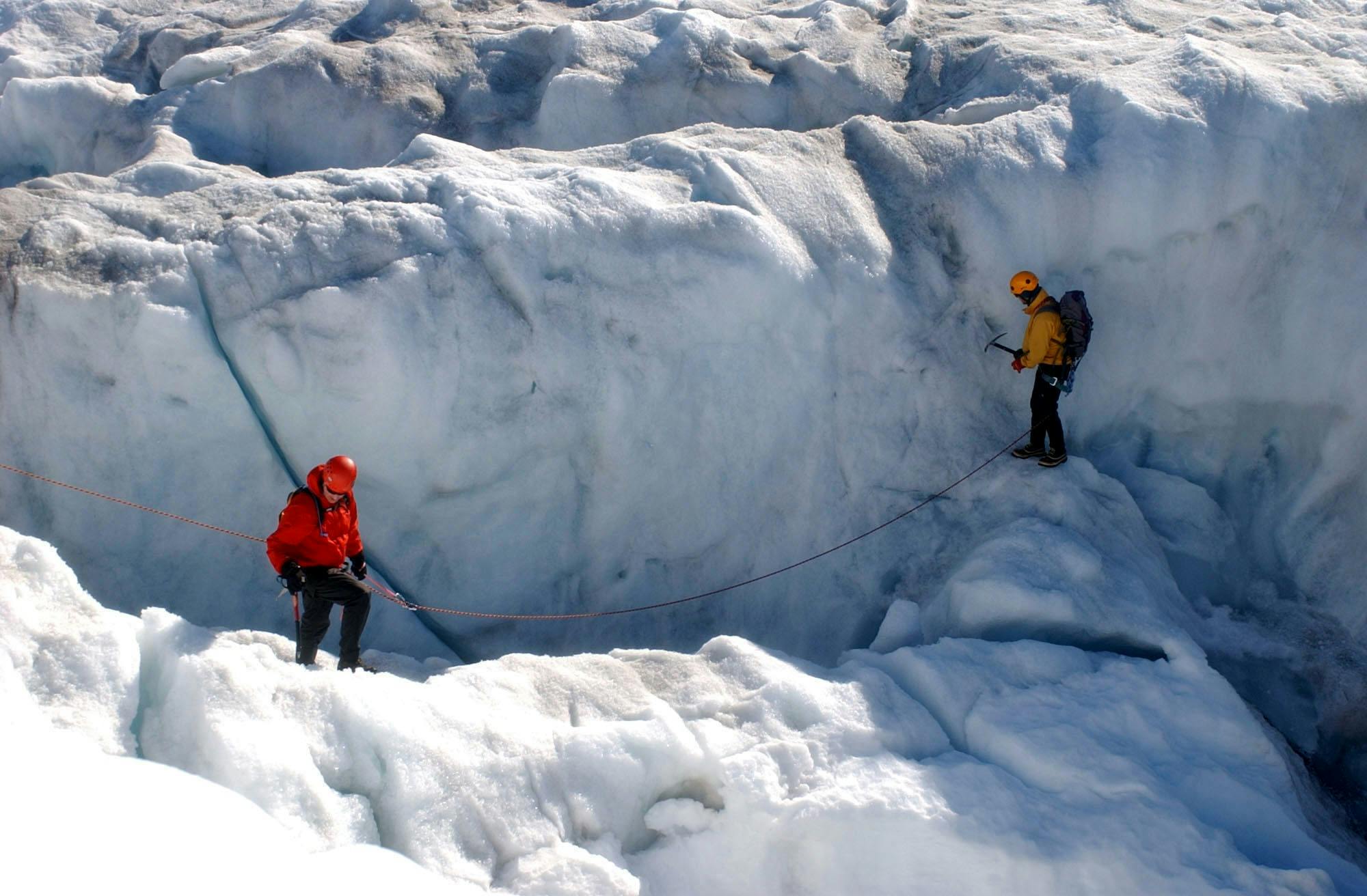
Mountain weather systems move rapidly, and what begins as a calm ascent can deteriorate into dangerous conditions within hours. The “death zones” on peaks like Everest, K2, and Denali earn their names not just from hypoxia but from the lethal combination of extreme cold and wind exposure.
💨 Hypoxia: The Silent Altitude Thief
Oxygen availability decreases exponentially with elevation. At 2,500 meters, barometric pressure drops to approximately 75% of sea-level values, meaning each breath delivers 25% less oxygen. By 5,500 meters, this reduces to 50%, and at 8,848 meters (Everest’s summit), climbers breathe air containing merely 33% of sea-level oxygen.
The hypoxia risk zone begins subtly around 2,000 meters, where most people experience minor symptoms. Moderate risk develops between 2,500-3,500 meters, high risk from 3,500-5,500 meters, and extreme risk above 5,500 meters—the threshold of the “death zone” where human physiology cannot permanently adapt.
Identifying Your Personal Hypoxia Threshold
Individual susceptibility to altitude illness varies dramatically based on genetics, acclimatization status, ascent rate, physical conditioning, and previous altitude exposure. Some people develop acute mountain sickness (AMS) at 2,000 meters, while others remain asymptomatic at 4,000 meters.
Key hypoxia symptoms include:
- Headache (often the first indicator)
- Nausea and loss of appetite
- Dizziness and lightheadedness
- Fatigue disproportionate to exertion
- Sleep disturbances and periodic breathing
- Cognitive impairment and poor judgment
The danger of hypoxia lies partly in its insidious nature. Reduced oxygen to the brain impairs decision-making precisely when good judgment becomes most critical. Climbers have died within meters of safety because hypoxia prevented them from recognizing their deteriorating condition.
📱 Technology for Elevation Risk Assessment
Modern technology provides unprecedented tools for monitoring environmental risks at elevation. Smartphone apps, wearable devices, and portable weather stations help adventurers make informed decisions about when to proceed, when to rest, and when to retreat.
Pulse oximeters measure blood oxygen saturation, providing objective data about hypoxia levels. Readings below 90% at altitude indicate significant hypoxia, while values under 85% suggest dangerous oxygen deprivation requiring immediate descent or supplemental oxygen.
Weather forecasting apps specifically designed for mountainous terrain provide crucial information about temperature trends, wind speed, precipitation, and visibility. These tools allow climbers to identify weather windows and avoid being caught in dangerous conditions.
🎯 Strategic Acclimatization: Working With Biology
The human body possesses remarkable adaptive capacity when given adequate time. Acclimatization—the physiological process of adjusting to reduced oxygen availability—requires patience and strategic ascent planning.
The golden rule “climb high, sleep low” remains fundamental. Ascending to higher elevations during the day stimulates adaptive responses, while sleeping at lower elevations allows recovery without excessive physiological stress. This pattern optimally triggers red blood cell production, capillary development, and metabolic adjustments.
Acclimatization Schedules for Different Zones
Proper acclimatization timelines vary based on target elevation:
- 2,500-3,500m: 1-2 days adjustment, minimal risk for most healthy individuals
- 3,500-4,500m: 3-5 days with rest days every 600-900m gained
- 4,500-5,500m: 5-10 days with multiple acclimatization rotations
- Above 5,500m: Extended expeditions with weeks of progressive exposure
Rushing acclimatization invites disaster. High-altitude pulmonary edema (HAPE) and high-altitude cerebral edema (HACE) can develop rapidly in inadequately acclimatized individuals, with potentially fatal consequences within hours if not treated promptly.
🧊 The Convergence Zone: Where All Threats Merge
The most dangerous elevations are where heat, cold, and hypoxia risks overlap and amplify each other. Between 3,500-5,000 meters in many mountain ranges, climbers face intense daytime solar radiation causing heat stress, dramatic nighttime temperature drops risking hypothermia, and significant hypoxia impairing physical and cognitive function.
This convergence zone demands comprehensive preparation. Layered clothing systems that adapt from morning cold through midday heat to evening freezing become essential. Hydration strategies must account for both altitude-induced fluid loss and temperature extremes. Nutrition must provide adequate calories to fuel both thermoregulation and the increased metabolic demands of hypoxic conditions.
Planning for Multi-Threat Environments
Successful navigation of convergence zones requires integrated risk management. Rather than preparing for heat, cold, or hypoxia in isolation, experienced mountaineers develop systems addressing all threats simultaneously.
Clothing selection emphasizes versatility. Base layers must wick moisture during exertion while retaining warmth during rest. Mid-layers provide insulation that works across temperature ranges. Outer shells protect from wind and precipitation while allowing vapor transmission. This system permits rapid adaptation as conditions change throughout the day.
Energy management becomes critical in convergence zones. The body’s caloric demands increase by 15-50% at altitude, with additional energy required for thermoregulation in temperature extremes. Carrying adequate nutrition and actually consuming it—despite altitude-suppressed appetite—separates successful summit attempts from dangerous failures.
🌡️ Personal Risk Factors: Know Your Vulnerabilities
Individual susceptibility to elevation risks varies based on numerous factors. Age, underlying health conditions, medications, genetic predisposition, and previous altitude experience all influence risk profiles.
Cardiovascular conditions increase vulnerability to both hypoxia and cold stress. Respiratory diseases like asthma may worsen at altitude despite the dry air paradoxically reducing some symptoms. Certain medications, particularly sedatives and alcohol, dangerously amplify hypoxia effects by depressing respiratory drive.
Previous positive altitude experiences don’t guarantee future success—acclimatization doesn’t persist indefinitely, typically degrading within 2-3 weeks of returning to lower elevations. Someone who summited a 6,000-meter peak last year requires similar acclimatization when returning this year.
⚡ Emergency Response: When Everything Goes Wrong
Despite perfect planning, emergencies occur in mountain environments. Recognizing when situations transition from manageable challenge to life-threatening crisis enables appropriate response before conditions become irreversible.
For heat-related illness, immediate cooling takes priority. Moving to shade, removing excess clothing, applying wet fabric to skin, and rehydrating can reverse early heat exhaustion. However, heat stroke—characterized by confusion, loss of consciousness, or core temperature exceeding 40°C—requires emergency evacuation.
Cold emergencies demand immediate rewarming for hypothermia victims. Mild hypothermia (32-35°C core temperature) responds to passive rewarming with dry clothing and insulation. Moderate to severe hypothermia requires active rewarming and immediate evacuation, as cardiac arrest risk increases dramatically below 30°C core temperature.
The Descent Decision: Recognizing the Point of No Return
For altitude illness, descent remains the only definitive treatment. Symptoms that worsen despite rest, ataxia (loss of coordination), severe headache unresponsive to medication, altered consciousness, or respiratory distress mandate immediate descent—minimum 500-1,000 meters, continuing until symptoms improve.
Summit fever—the psychological drive to reach the top despite deteriorating conditions—has killed more mountaineers than technical difficulty. Establishing objective turnaround criteria before the climb (specific times, weather thresholds, symptom triggers) removes emotional decision-making from critical moments.
🔄 Integrating Risk Management into Adventure Planning
Conquering the elements at elevation requires more than physical fitness and technical skill. It demands comprehensive understanding of how environmental factors change with altitude, honest assessment of personal vulnerabilities, appropriate preparation, and disciplined decision-making under stress.
The most successful high-altitude expeditions share common characteristics: conservative timelines allowing proper acclimatization, comprehensive gear systems addressing multiple environmental threats, clear communication protocols, established turnaround criteria, and team cultures that prioritize safety over summits.
Training for elevation should simulate environmental challenges. Heat training in saunas or hot environments, cold exposure protocols, and hypoxic training at altitude or using simulated altitude systems prepare the body for mountain conditions. However, no amount of sea-level training fully replicates the combined stresses of high-altitude environments.
🌄 Beyond Survival: Thriving at Altitude
Understanding high-risk elevation zones transforms mountain adventures from survival ordeals into calculated challenges. Knowledge of heat stress zones, cold exposure thresholds, and hypoxia risks enables strategic planning that maximizes safety while preserving the adventure that draws us to mountains.
The vertical world offers experiences impossible elsewhere—perspectives from summits that few witness, the crystalline clarity of high-altitude starscapes, the satisfaction of pushing personal limits in demanding environments. But these rewards require respect for elemental forces that operate on scales beyond human control.
Whether you’re planning a weekend trek to 3,000 meters or a multi-week expedition above 7,000 meters, the principles remain constant: understand the risks specific to your target elevation, prepare comprehensively for those threats, acclimatize progressively, monitor conditions continuously, and maintain the discipline to retreat when circumstances demand. These practices don’t eliminate risk—nothing does in mountain environments—but they shift odds decisively in your favor.
The mountains will always be there, waiting for another attempt. Your life and health won’t be if you push beyond reasonable limits. Conquering the elements begins with respecting their power and planning accordingly. 🏔️


