
Altitude mapping in extreme mountain ranges combines cutting-edge technology with human determination, transforming how we understand Earth’s highest peaks. 🏔️
The Himalayas and Andes represent two of the most challenging and scientifically significant mountain systems on our planet. These towering ranges have captivated explorers, scientists, and cartographers for centuries, yet accurately mapping their altitudes has remained one of geography’s most formidable challenges. Today, advanced technologies combined with traditional surveying methods are revolutionizing our understanding of these colossal landscapes, revealing insights that extend far beyond simple elevation measurements.
The Evolution of Mountain Altitude Measurement 📏
Altitude mapping has undergone a remarkable transformation since the earliest attempts to measure mountain heights. Traditional methods relied heavily on theodolites and triangulation, requiring surveyors to establish baseline measurements and calculate heights through geometric principles. The Great Trigonometrical Survey of India, which began in 1802, exemplified this painstaking approach, eventually determining Mount Everest’s height through observations from distances exceeding 160 kilometers away.
Modern altitude mapping integrates multiple technologies including Global Navigation Satellite Systems (GNSS), LiDAR (Light Detection and Ranging), synthetic aperture radar (SAR), and photogrammetry. These tools provide unprecedented accuracy while dramatically reducing the time and physical risk associated with high-altitude surveying. The convergence of these technologies has enabled researchers to create detailed three-dimensional models of mountain terrain with centimeter-level precision.
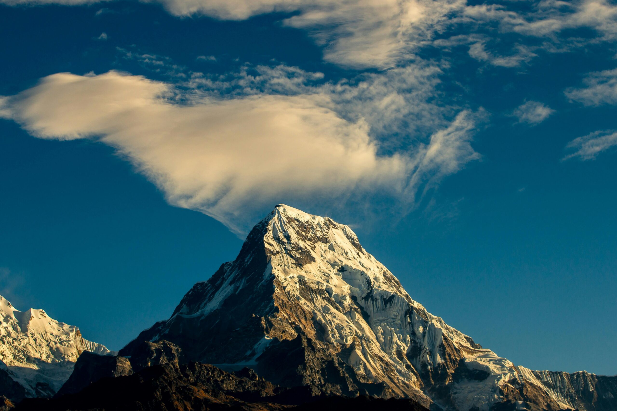
Himalayan Heights: Mapping the Roof of the World 🌏
The Himalayan mountain range stretches approximately 2,400 kilometers across five countries, containing all of Earth’s peaks exceeding 8,000 meters. This geological marvel presents unique mapping challenges due to extreme elevations, severe weather conditions, political boundaries, and constantly shifting glaciers and snowfields.
The Everest Remeasurement Projects
Mount Everest, known as Sagarmatha in Nepal and Chomolungma in Tibet, has been measured numerous times throughout history, with results varying significantly. In 2020, Nepal and China jointly announced a revised official height of 8,848.86 meters, representing the most accurate measurement to date. This collaborative effort utilized GNSS receivers placed at the summit, ground-penetrating radar to determine snow depth, and gravity measurements to establish the precise geoid model.
The 2020 survey team faced extraordinary challenges. Surveyors had to acclimatize to extreme altitudes, carry sensitive equipment through the treacherous Khumbu Icefall, and establish measurement stations in the “death zone” above 8,000 meters where oxygen levels are insufficient to sustain human life. The GNSS receiver operated at the summit for 150 minutes, collecting data from multiple satellite systems to achieve unprecedented accuracy.
Glacier Dynamics and Climate Change Monitoring
Altitude mapping in the Himalayas extends beyond peak measurements to comprehensive glacier monitoring. The region contains approximately 54,000 glaciers covering roughly 60,000 square kilometers. These ice masses are retreating at alarming rates due to climate change, making accurate altitude mapping essential for understanding water resources and predicting environmental impacts.
Researchers have employed repeat-pass satellite interferometry to measure glacier thinning rates across vast areas. Studies utilizing data from satellites like ASTER (Advanced Spaceborne Thermal Emission and Reflection Radiometer) and the SRTM (Shuttle Radar Topography Mission) have revealed average glacier thickness losses of approximately 0.5 meters per year across the Himalayas since 2000. These measurements provide critical data for climate models and water resource management strategies affecting over two billion people downstream.
Andean Altitudes: Mapping the Longest Continental Range ⛰️
The Andes mountain system extends approximately 7,000 kilometers along South America’s western edge, making it the world’s longest continental mountain range. While lacking the extreme elevations of the Himalayas, the Andes present distinct mapping challenges including volcanic activity, diverse climate zones, and complex geological structures.
Volcanic Peak Monitoring in the Central Andes
The Central Andes host numerous active volcanoes, requiring continuous altitude monitoring to detect summit deformation that may indicate volcanic activity. The Ojos del Salado, straddling the Chile-Argentina border, exemplifies the complexities of Andean altitude mapping. Long considered the world’s highest volcano at approximately 6,893 meters, precise measurements have been complicated by its remote location and the difficulty of determining whether its summit represents a volcanic cone or merely high terrain adjacent to volcanic features.
Modern monitoring programs employ Interferometric Synthetic Aperture Radar (InSAR) to detect millimeter-scale changes in volcanic edifice heights and shapes. These measurements have proven invaluable for volcanic hazard assessment, detecting inflation or deflation that might precede eruptions. Ground-based GNSS networks complement satellite observations, providing real-time deformation data for risk management.
The Aconcagua Measurement Campaign
Aconcagua, South America’s highest peak at approximately 6,961 meters, has been the subject of multiple precise altitude mapping campaigns. A comprehensive 2012 survey combined traditional geodetic methods with modern GNSS technology to establish a definitive elevation. The project required establishing a network of reference stations at lower elevations, then progressively advancing measurement stations upward while maintaining continuous satellite connectivity.
The Aconcagua case study demonstrated how altitude mapping contributes to climbing safety and environmental management. The detailed topographic models generated from the survey data have been integrated into navigation systems and climbing guides, helping expeditions plan safer routes and respond more effectively to emergencies.
Technological Breakthroughs Enabling Precision 🛰️
Several technological advances have revolutionized altitude mapping in extreme mountain environments, making previously impossible measurements routine.
Satellite Positioning Systems
GNSS technology has transformed altitude surveying by enabling precise three-dimensional positioning anywhere on Earth. Modern multi-constellation receivers access signals from GPS, GLONASS, Galileo, and BeiDou satellites simultaneously, improving accuracy and reliability even in challenging mountain environments where satellite visibility may be limited by topography.
Real-Time Kinematic (RTK) positioning allows centimeter-level accuracy by comparing observations from a stationary base station with a mobile receiver. In mountain mapping applications, surveyors establish temporary base stations at known positions, then conduct measurements at higher elevations while maintaining radio or cellular data connections for differential corrections.
Airborne and Spaceborne Remote Sensing
LiDAR technology has become indispensable for creating detailed elevation models of mountain terrain. Airborne LiDAR systems emit millions of laser pulses per second, measuring the time required for each pulse to return after reflecting from the ground surface. This generates point clouds containing billions of precisely positioned elevation measurements.
In the Andes, helicopter-mounted LiDAR systems have mapped extensive areas of high-altitude terrain with vertical accuracies better than 15 centimeters. These surveys reveal subtle topographic features invisible in conventional mapping, including small-scale glacial features, rockfall hazard zones, and archaeological sites at extreme elevations.
Satellite-based radar systems like TanDEM-X have generated global elevation models with unprecedented coverage and consistency. These systems overcome cloud cover limitations that affect optical sensors, making them particularly valuable for mapping frequently clouded mountain regions.
Practical Applications Beyond Scientific Curiosity 🎯
Altitude mapping in the Himalayas and Andes generates data with far-reaching practical applications that justify the considerable investments required.
Disaster Risk Management
Detailed elevation models enable sophisticated modeling of potential disasters including avalanches, landslides, glacial lake outburst floods (GLOFs), and volcanic lahars. In both mountain ranges, altitude mapping has identified hundreds of potentially dangerous glacial lakes whose failure could devastate downstream communities.
Following the 2015 Nepal earthquakes, rapid altitude mapping using satellite radar interferometry revealed ground subsidence patterns and helped prioritize reconstruction efforts. Similar techniques monitor slow-moving landslides in the Andes, providing early warning for communities at risk.
Infrastructure Planning and Engineering
Transportation corridors, hydroelectric projects, and communication networks in mountain regions require precise elevation data for design and construction. The Qinghai-Tibet Railway, reaching elevations above 5,000 meters in the Himalayas, relied extensively on detailed altitude mapping to plan gradients, tunnels, and avalanche protection structures.
In the Andes, mining operations at extreme elevations utilize high-resolution topographic data for optimizing haul road designs, planning tailings facilities, and monitoring slope stability in mine walls.
Challenges That Persist Despite Technological Progress 🌨️
Despite remarkable advances, altitude mapping in extreme mountain environments continues to face significant obstacles that limit accuracy and coverage.
Atmospheric conditions profoundly affect measurement accuracy. GNSS signals refract as they pass through the atmosphere, with water vapor causing particularly unpredictable delays. At high altitudes where atmospheric pressure and water vapor content differ significantly from lower elevations, standard correction models may introduce errors of several centimeters.
Defining precisely what constitutes the “true” summit elevation remains philosophically and practically complex. Should measurements reference the top of snow and ice accumulation, or the underlying bedrock? In the Himalayas, winter snow accumulation can add several meters to summit heights, while in the Andes, volcanic peaks may have no stable rock summit to reference.
Political sensitivities complicate many high-altitude mapping projects. Mountains straddling international borders may have disputed elevations reflecting nationalistic pride as much as scientific measurement. Access restrictions for security or sovereignty reasons can prevent surveyors from conducting comprehensive measurements.
The Human Element in Extreme Altitude Mapping 🧗
Technology alone cannot accomplish altitude mapping in the world’s highest mountains. Human surveyors must still reach extreme elevations carrying equipment, establish measurement stations, and conduct observations in life-threatening conditions.
The 2020 Everest survey team included Khim Lal Gautam, who reached the summit carrying a GNSS receiver and conducted measurements despite oxygen deprivation, extreme cold, and exhaustion. Such efforts exemplify how altitude mapping remains as much about human endurance as technological capability.
Training programs in Nepal and several South American countries now prepare local surveyors specifically for high-altitude mapping work, building technical capacity while providing employment opportunities in mountain communities. These programs recognize that successful altitude mapping requires both technological expertise and mountain skills including climbing, avalanche awareness, and high-altitude physiology.
Future Horizons in Mountain Altitude Mapping 🔭
Emerging technologies promise to further revolutionize how we map mountain altitudes, potentially enabling continuous monitoring of elevation changes across entire mountain ranges.
Unmanned aerial vehicles (UAVs or drones) equipped with miniaturized LiDAR and photogrammetry systems can potentially reach altitudes previously requiring manned aircraft or ground-based surveyors. However, technical challenges including reduced battery performance in cold temperatures and thin air, plus regulatory restrictions, currently limit drone applications above approximately 6,000 meters.
Machine learning algorithms are being developed to automatically extract elevation information from satellite imagery, potentially enabling rapid mapping of remote regions without requiring ground control points. These systems could provide near-real-time detection of major topographic changes caused by earthquakes, volcanic eruptions, or massive landslides.
Quantum sensor technology may eventually provide gravity measurements precise enough to determine elevations without requiring line-of-sight to satellites or reference stations. Though currently laboratory-bound, portable quantum gravimeters could revolutionize surveying in deep valleys and other locations where satellite visibility is poor.
Lessons From the Peaks: What Mountain Mapping Teaches Us 📚
The case studies of altitude mapping in the Himalayas and Andes reveal insights extending beyond technical accomplishments. These projects demonstrate how international scientific collaboration can transcend political tensions, with the joint Nepal-China Everest measurement exemplifying cooperation on neutral scientific ground.
They illustrate the importance of combining traditional knowledge with modern technology. Indigenous mountain communities possess invaluable understanding of terrain, weather patterns, and safe travel routes that complement technological capabilities. Successful mapping projects integrate this local expertise with cutting-edge instruments.
Perhaps most significantly, precision altitude mapping in extreme environments reminds us that Earth’s geography continues to change. Mountains rise through tectonic uplift, erode through weathering, and lose ice mass through climate change. What we measure today provides a baseline for understanding tomorrow’s changes, making these surveys essential records of a dynamic planet.
The pursuit of ever-more-accurate altitude measurements in the world’s highest mountains represents humanity’s drive to understand and document our environment with precision. Each centimeter of improved accuracy, each square kilometer of newly mapped terrain, adds to our collective knowledge and enables better stewardship of these magnificent landscapes. As technology advances and human determination persists, we continue reaching new heights—both literally and figuratively—in our quest to map the roof of the world.


